Annapurna Base Camp Trail Medal, front and back, on a rock with the Annapurna range behind

COMING SOON

Annapurna Base Camp

Trail / Location

Nepal

Description

Inspired by the unforgettable journey to Annapurna Base Camp at 4,130m, this Trail Medal captures the landscapes, culture and experiences that define the trek through the Himalayas. The front brings the trail to life with the Annapurna mountain range and Machapuchare (Fishtail) Peak, alongside a trekker, suspension bridge, traditional mountain tea houses, colourful prayer flags, Nepal flag and rhododendrons - Nepal's national flower. The reverse features a topographic contour design with the trekking route marked through Nayapul, Ghandruk, Chhomrong, Bamboo, Deurali and Machapuchare Base Camp (MBC), before finally reaching Annapurna Base Camp (ABC). Trekking poles complete the design, representing the journey made on foot through the mountains. The medal also carries the latitude and longitude coordinates 28.5300° N, 83.8780° E, together with the 4,130m elevation, marking the destination this medal was created to remember. Finished with a custom ribbon featuring Himalayan mountain graphics, the Nepal flag and "ANNAPURNA BASE CAMP • 4,130 M • NEPAL." Every detail tells a part of the trail. Every medal remembers the journey.


Front of the Annapurna Base Camp Trail Medal
Back of the Annapurna Base Camp Trail Medal

The story

THE STORY BEHIND THE MEDAL

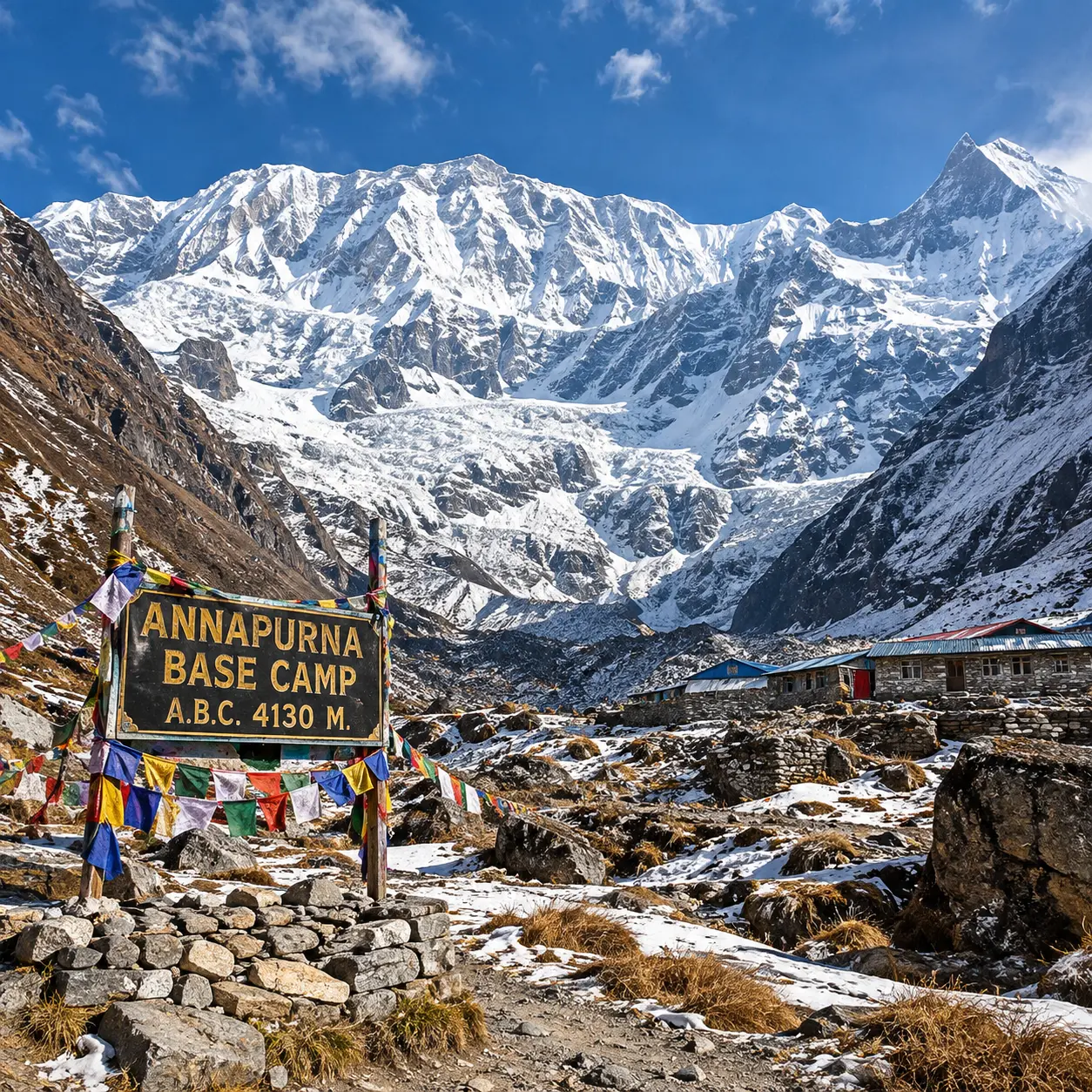
Annapurna Base Camp sign and prayer flags with the Annapurna Sanctuary peaks behind

The trail

The journey to Annapurna Base Camp begins from the hills beyond Pokhara, with common trailheads at Ghandruk, Jhinu Danda, Matkiu or Nayapul. From there, the route passes through traditional Gurung villages, terraced farmland and welcoming mountain teahouses before entering the Annapurna Sanctuary. The terrain changes constantly throughout the trek. Long stone staircases lead through dense rhododendron and bamboo forests, while suspension bridges cross rivers and deep valleys below. Beyond Deurali, the trees disappear and the trail opens into a dramatic high-altitude landscape of rock, snow and glacial terrain. The final approach passes Machapuchare Base Camp before reaching Annapurna Base Camp at 4,130 metres. Depending on the chosen trailhead and whether Ghorepani and Poon Hill are included, the trek usually covers approximately 70–95 kilometres and takes around 7–11 days. Most days involve five to seven hours of walking, with repeated climbs, descents and increasing altitude making the route physically demanding. What makes this trek unlike many others is the way it leads directly into the heart of the mountains. At base camp, trekkers stand inside the vast natural amphitheatre of the Annapurna Sanctuary, surrounded by Annapurna I, Annapurna South, Hiunchuli, Gangapurna and the unmistakable summit of Machapuchare. Prayer flags, stone villages, mountain bridges and teahouses remain part of the journey, but it is the close, uninterrupted circle of Himalayan peaks that makes arriving at ABC unforgettable. At a glance: Location: Annapurna Conservation Area, Nepal Highest point: Annapurna Base Camp 4,130 m Distance: Approximately 70–95 km, depending on the route Typical duration: 7–11 trekking days Difficulty: Moderate to challenging Terrain: Stone steps, forest paths, suspension bridges and high-altitude glacial terrain Major landmarks: Chhomrong, Deurali, Machapuchare Base Camp and Annapurna Base Camp Best seasons: March–May and September–November

Interested in Annapurna Base Camp?

Register Your Interest